
Last verified by Nima Parham — 27 October 2026.
Research review: 27 October 2026. Access and cultural protocols vary by site. A distinctive landform is not automatically open for climbing, collecting rocks or photography in every location.
The phrase rock formations in Australia covers processes that are often mistakenly compressed into one story about ‘wind and water over millions of years’. Different rocks preserve different geological histories. A sandstone dome, an eroding limestone sea stack and a granite wave are not interchangeable attractions, even if all appear spectacular in photographs.
A useful way to explore them is to ask three questions of each place: What is the rock? Which forces made its present shape? Whose land and cultural landscape are visitors entering? The answers change what you should look for and how you should behave.
Uluṟu: a rock and a living cultural landscape
Uluṟu is not simply a pile of desert boulders. Its geological formation reflects sedimentation, burial, deformation and erosion over immense spans of time. The visible rock is part of a larger geological structure, and its changing appearance in different light should not obscure that complex history.
It is also a place of continuing Anangu authority. Parks Australia’s cultural information places Traditional Owners at the centre of understanding the landscape. Visitors should respect restrictions on climbing, imagery and culturally sensitive locations. Science explains physical processes; it does not replace the right of custodians to determine how cultural knowledge is shared.
If visiting the national park, focus on authorised walks and interpretation. Avoid following online advice that encourages access to closed areas. The most valuable experience comes from listening as well as looking.
The Twelve Apostles: erosion that continues today
Victoria’s Port Campbell coast illustrates why geological attractions cannot be treated as permanent sculptures. The Parks Victoria management information describes limestone cliffs and the powerful marine environment shaping this coast. Waves and weather exploit weaknesses in limestone, producing caves, arches and, after collapse, isolated sea stacks.
The rock formations known as the Twelve Apostles are therefore a phase in an ongoing sequence. Their number and shapes change with erosion; the name is not a reliable count of standing pillars. Some visitors think a viewpoint is safe because it has existed for decades, but unstable cliff edges can change after heavy rain and rough seas. Stay behind barriers and use official viewing areas.
Wave Rock: granite that looks like moving water
Wave Rock near Hyden in Western Australia is an overhanging, wave-shaped face in a much older granite landscape. Its appearance emerges from long-term weathering and removal of material, not a giant ocean wave frozen in stone. It is an excellent reminder that a familiar-looking shape may have an unfamiliar geological origin.
The visual effect is especially striking when moisture and mineral staining create coloured bands on the rock face. Those colours do not mean the rock was layered like sedimentary sandstone. A geological feature can combine structure, chemistry and surface conditions in its appearance. At the site, use established paths and avoid damaging fragile surrounding habitat.
Purnululu: the striped sandstone domes
The Bungle Bungle Range in Purnululu National Park is known for bands on its rounded sandstone forms. The stripes are associated with different weathering and biological processes at the surface. This is not an appropriate place to invent a single simple formula for all the colours.
Access can be seasonal and driving conditions demanding. Treat the Western Australia parks visitor information as the starting point for road, walking and safety notices. A long, rough approach changes the type of trip required; do not sell this as a brief stop on an ordinary city-to-city drive.
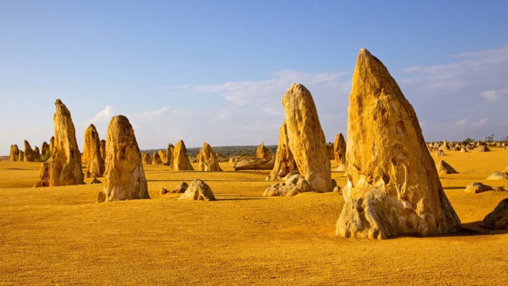
The Pinnacles: small forms, a different limestone story
The Pinnacles in Nambung National Park add another dimension: slender limestone forms emerging from a sandy landscape. Their origin involves geological and soil processes, not the high-energy marine erosion that produces the Twelve Apostles. Comparing the two teaches more than putting both under the headline ‘limestone rocks’.
Use official driving and walking routes and respect fragile surfaces. A photograph taken from a permitted track can convey the scene without trampling or touching the features. Visitor facilities and road conditions should be checked in advance through WA Parks.
How to compare formations without losing the story
For each site, note the material, the principal shaping forces and the timescale involved. Sandstone, granite and limestone respond differently to water, temperature, biological activity and gravity. Even at a single site, the existing rock may be far older than the exposed landform visitors see today.
Then add access and cultural authority to the comparison. A national park is not a free-for-all landscape; it can be a place of active Traditional Owner management, habitat protection and serious geotechnical hazards. Respecting those responsibilities is part of learning from the geology.
Australia’s geological variety rewards readers who resist the urge to rank everything as ‘the strangest rock’. The interest lies in why these forms differ—and what their differences reveal about place, deep time and the people responsible for caring for them.