
Last verified by Nima Parham — 27 October 2026.
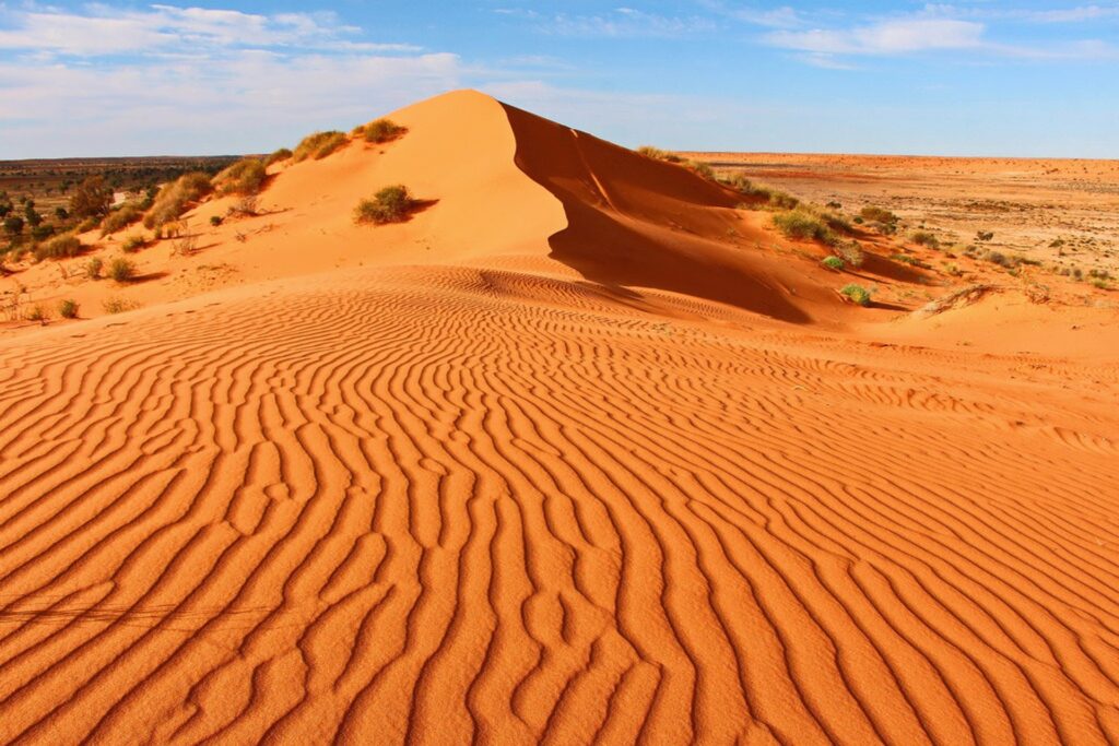
A sand dune looks permanent until you examine its surface closely. Wind carries grains over a crest, footsteps break a fragile skin of vegetation, and a change of weather redraws the slope. Australian sand dunes occur in remarkable settings: coastal systems beside the sea, vast inland dune fields and dramatic migrating sandblows on large sand islands. Their appearance may be similar in a photograph, but their ecology, history and visitor rules are not interchangeable.
A practical guide begins by asking what the sand is doing. Is it a coastal buffer exposed to storms? Is it part of an inland arid landscape? Is it a dune on K’gari formed by ongoing accumulation and movement? The answer changes how you should explore it, and whether a trip is possible at all.
What makes a dune—and why the shape moves
Dunes develop when wind transports loose sand and leaves it where the wind slows, often around plants, landforms or other obstacles. If the supply of sand continues, a crest can build and change shape. Some dunes migrate as grains move from a windward slope over the top and settle on the sheltered side. Other systems become more stable when plants establish roots and bind the surface.
This is not simply a matter of the strongest wind making the tallest pile. Grain size, moisture, vegetation, sediment supply and the direction of prevailing winds all influence the form. On a coast, waves and storms add another layer of complexity: beaches may exchange sand with adjacent dunes, which in turn protect land behind them from some storm impacts.
The process explains why walking or driving across an apparently empty dune can cause damage. A vehicle may cut through vegetation or disturb a sensitive surface; a walker may enter a protected cultural site without recognising it. The Queensland Parks guidance for K’gari advises visitors to stay on formal tracks and designated roads, a practical rule rooted in the protection of a highly dynamic landscape.
Three Australian dune settings that need different decisions
K’gari: sandblows, lakes and forests on one island
Queensland’s K’gari is a dramatic example of a sand landscape that supports forests, wetlands and clear lakes as well as open dunes. The island’s official Great Walk description describes a route of up to 90 kilometres through a succession of environments, including dune systems and culturally important places. The landscape is not an empty desert: it is part of Country with a long human history and active conservation management.
Shorter choices exist, but do not confuse them with a stroll along a city beach. The Queensland Parks walking-track summary provides graded distances and access information. For instance, some trips to the island’s sandblows involve soft sand, steep gradients and several hours of walking. The routes should be chosen according to fitness, daylight and the availability of safe transport to the trailhead.
The Queensland Parks safety page warns that soft sand and steep sections can lead to fatigue and heat exhaustion. Carry sufficient drinking water, wear sun protection and avoid the hottest part of the day. Conditions can change and access may be restricted after storms, fire or infrastructure works.
Worimi Conservation Lands: dunes governed by culture and access rules
Near Newcastle in New South Wales, the dunes of the Worimi Conservation Lands are visually striking and culturally significant. The NSW government states that the lands are owned and co-managed by the Worimi Aboriginal community. The Worimi State Conservation Area visitor information explains that the landscape contains important ancient cultural sites.
This is not a free-for-all driving playground. The official park guidance says beach driving requires a specific vehicle permit and that a standard NSW National Parks pass is not valid for vehicle entry. Visitors must follow authorised driving areas, current safety instructions and local cultural protections. If you are not an experienced beach driver, consider an appropriately authorised guided visit rather than treating the dunes as an experimental track.
The Worimi National Park visitor page also cautions that weather and fire danger can affect access. A published permit system is not a guarantee that every sector is open on your chosen date.
Wilsons Promontory’s Big Drift: a scenic dune walk, currently affected by closure
Victoria’s Wilsons Promontory National Park is known for beaches and bushwalking, and the Big Drift dune system has been promoted as a distinctive landscape. However, visiting conditions are time-sensitive. As checked on 26 October 2026, Parks Victoria’s current changes-of-conditions listing states that the Big Drift Walk and Stockyard car park are closed while critical works take place. Visitors should not follow old itineraries that assume normal access.
The lesson extends to every dune destination: the existence of a famous landmark is not proof that you can reach it now. Construction, dune stabilisation, habitat protection and emergency operations can all affect access. Check the responsible park agency immediately before travel and obey closure signs, even if social media shows people standing there last year.
Inland dunes are not the same as coastal dunes
Australia’s interior contains extensive arid and semi-arid dune landscapes. Their patterns are shaped by long-term wind regimes, aridity and vegetation. To describe them merely as “beach dunes far from the ocean” would miss the history of their formation, the age and composition of their sediments and the living communities associated with them.
For travellers, the bigger distinction is remoteness. A trip into an inland dune area can mean long stretches without water, reliable communications or medical assistance. Vehicle suitability, local road notices, land-access permissions and planned return times should be checked before departure. Do not infer that an aerially photographed dune is accessible to the general public.
Other remarkable sandy landscapes can be lunettes rather than conventional mobile linear dunes. In Mungo National Park, the NSW National Parks guided-tour programme interprets the Walls of China landscape with Aboriginal guides. It is important to name these landforms accurately and follow the site’s guided-access and cultural-heritage arrangements, rather than using “sand dune” as a catch-all for every eroded ridge.
How to visit a dune without damaging it
The first rule is to check the manager of the land. On K’gari, that means current Queensland Parks track information and safety advice. On Worimi land, consult NSW National Parks vehicle and permit conditions. For Big Drift, check the Parks Victoria closure list rather than outdated visitor photographs.
Take water, protective clothing and a reliable plan for the return journey. Sand absorbs and reflects heat; climbing a soft slope is more tiring than the apparent distance suggests. The Cancer Council UV Index guidance recommends sun protection at UV 3 or above, including on cloudy days. If a dune walk has no shade, time and weather matter more than impressive photography.
Avoid walking through dune vegetation and leave no litter. Keep well away from unstable edges and do not drive off permitted routes. A protected dune may contain bird habitat, archaeological sites or vegetation that holds the system together. Its fragility is often invisible to someone looking only at the sand.
If you are planning a family outing, choose a walk with clearly published length, grade and amenities. The K’gari journey directory lets visitors distinguish short walks from longer routes. A parent with young children or a visitor with limited mobility needs that detail; “easy sand walk” is not a meaningful accessibility promise.
Reading the landscape, not collecting landmarks
A sand dune can be a defence against the sea, a habitat, a geological record and a place with profound cultural meaning. The same grains that create a dramatic photograph may be part of an ecosystem dependent on a surprisingly delicate balance of wind and vegetation. That is why accurate travel writing should pair wonder with rules.
For 2026, the most practical takeaway is simple: K’gari is a walking landscape requiring preparation; Worimi dunes have specific co-management and vehicle permits; and Big Drift is listed as closed while works continue. Check those statements again before travel because access conditions can change. The best encounter with Australia’s dunes leaves the landform—and the people and wildlife connected to it—undisturbed.